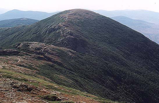
Looking south from Monroe
Mt Eisenhower - 4761'
Until 1972 this mountain was known as Mt Pleasant. It was renamed by the NH state legislature in honor of the former president, partially through the influence of Gov The summit is open with 360 degree views. The most direct route to the summit is up the Edmands Path, which starts at a parking area on the Mt Clinton Road. It climbs 3.0 miles until it meets the Crawford Path just .4 miles north of the summit, near Red Pond. The actual summit is reached by taking the Eisenhower Loop trail, which rejoins the Crawford Path to the south.
The peak is set in the middle of the southern Presidential ridge, between Monroe to the north, and Pierce to the south. The Crawford Path, part of the AT, runs along the entire ridge, from Crawford Notch to Mt Washington.
Trailheads
- Edmands Path - From the top of Crawford Notch, take the Mt Clinton Road 2.3 miles to a parking area on the right. A WMNF Parking Pass is required.
- Ammonoosuc Ravine - From Rt 302 in Bretton Woods, take the Base Road 6 miles to the trailhead parking area on the right, just before the Cog Railroad. A WMNF Parking Pass is required.
Additional Photos
- Looking south from Monroe
- View north from summit
- Looking north from Pierce summit
- Eisenhower and Washington
- From the Crawford Path
- Sitting on the summit
- North of the summit on the Eisenhower Loop
- Stone Gate on Edmands Path
- Summit grasses
- Rounding the bend atop the Edmands Path
- Red Pond from above
- Summit shot
- Southern Presidentials at dawn from Monroe
- From the Cog RR base station
- Washingon, Monroe, and Eisenhower
- Southern Presidentials
- Rockwork on the Edmands Path
- Warning sign on Edmands Path
- Summit from Crawford Path
- Summit on a summer day
- Eisenhower from Clinton on a grey day
- From Mt Eisenhower Rest Stop on Rt 302
- Eisenhower, Monroe, and Lakes inwinter
Trip Reports
- Summer dayhike of Pierce and Eisenhower
- Newer trip report up the Edmands Path
- Trip report up the Edmands Path
- Southern Presidentials trip report
- Eisenhower and Monroe trip report
- Southern Presidental Traverse
- One Day Presidential Traverse